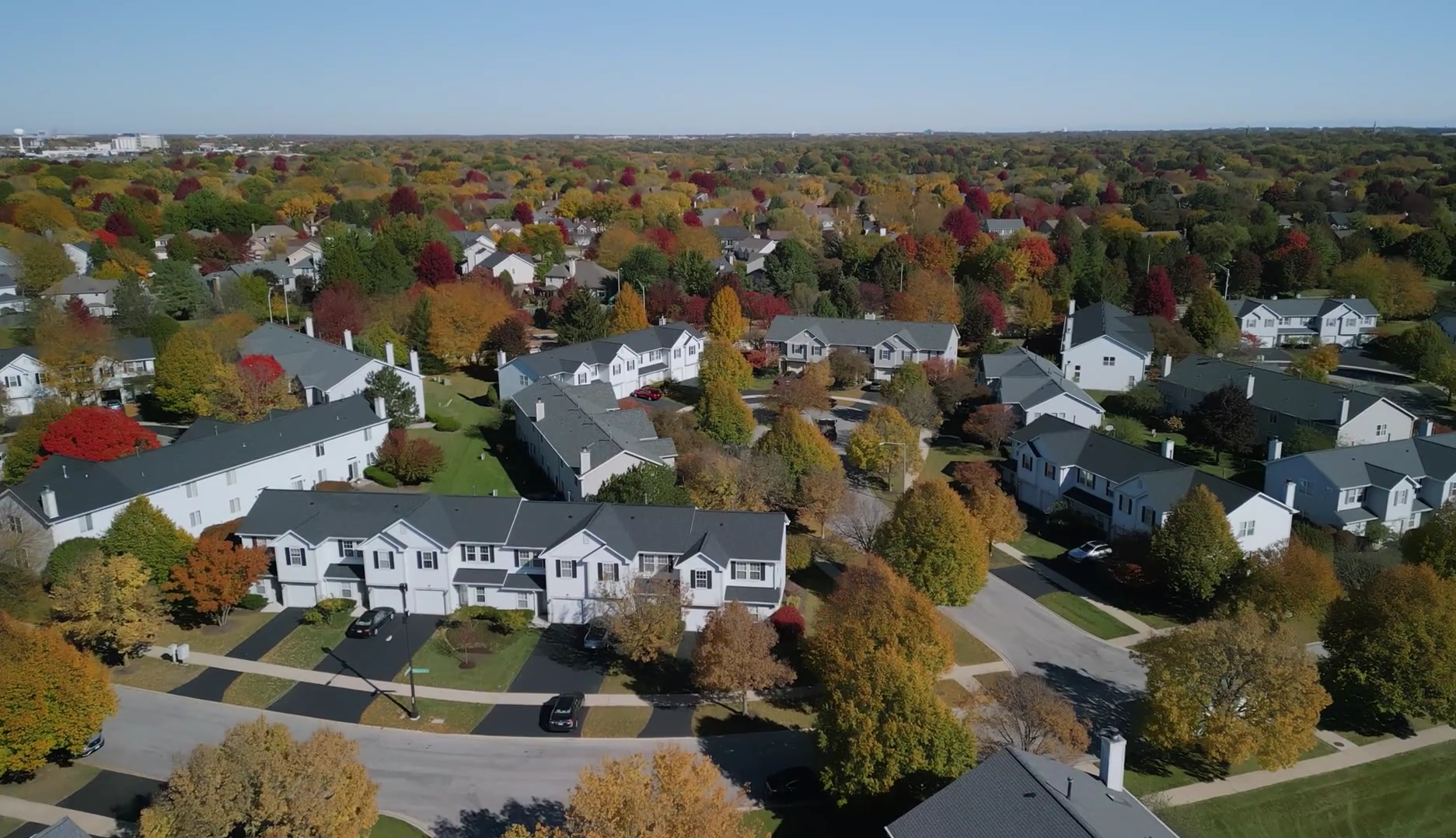
While most pilots compete for $200 photo jobs, our students are earning $1,000+ per project delivering comprehensive property marketing packages. The difference? A complete system that combines cinematic aerials, virtual tours, and 3D models into powerful visual stories that help agents close deals.
Learn the exact production techniques and business strategies we’ve used to sell over $250 million in properties – all packaged into one comprehensive bundle.

 We’ve assisted Netflix producers and production managers on several projects. This includes flying to produce 3D models they used for location and set planning.
 More than 100 Tesla drone pilots from their solar group have used our online training for both Part 107 prep and understanding safe drone operations.
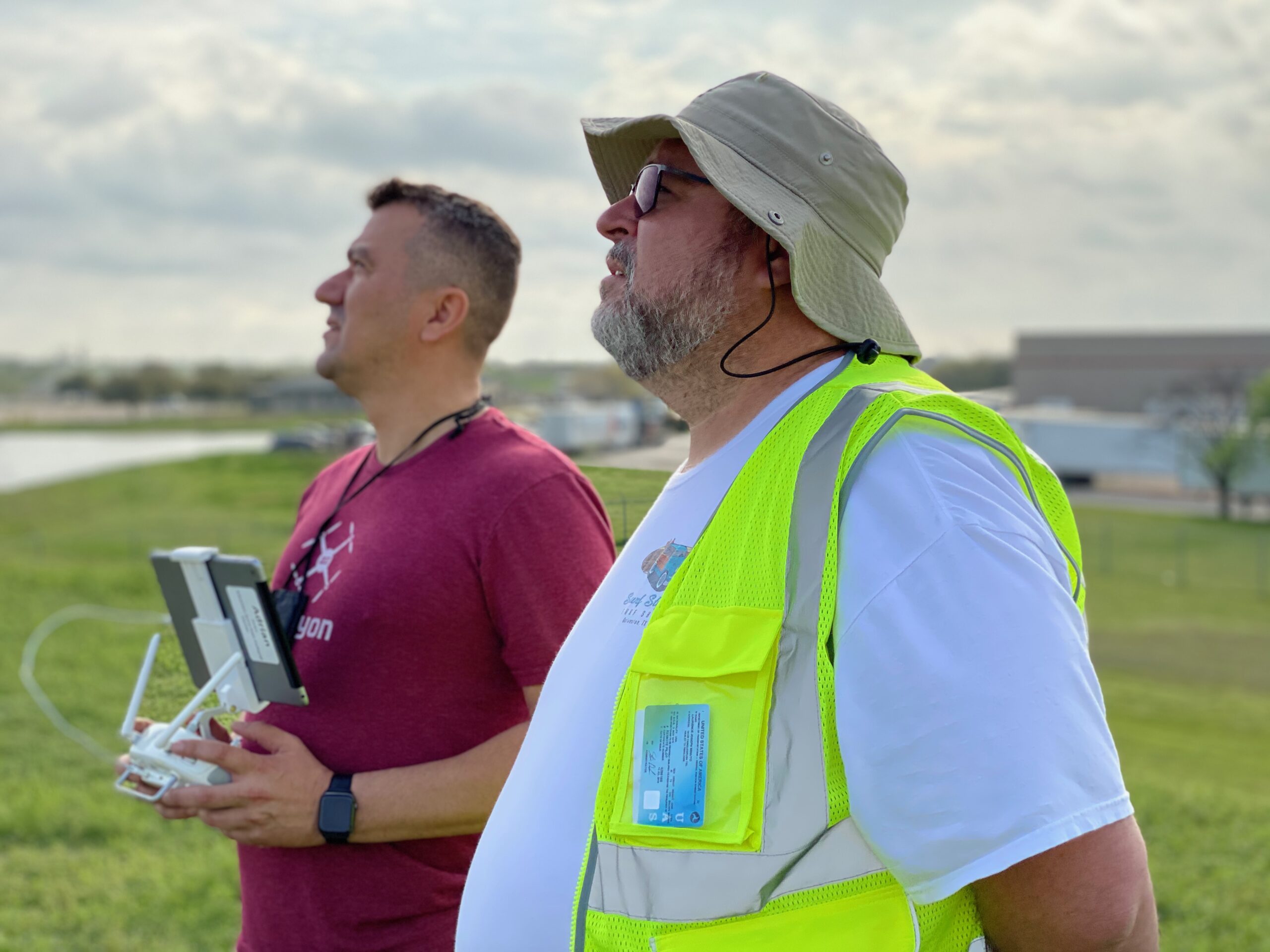
 We’ve performed drone flights for several of their wake surfing events, as well as flights for many of their boat commercials
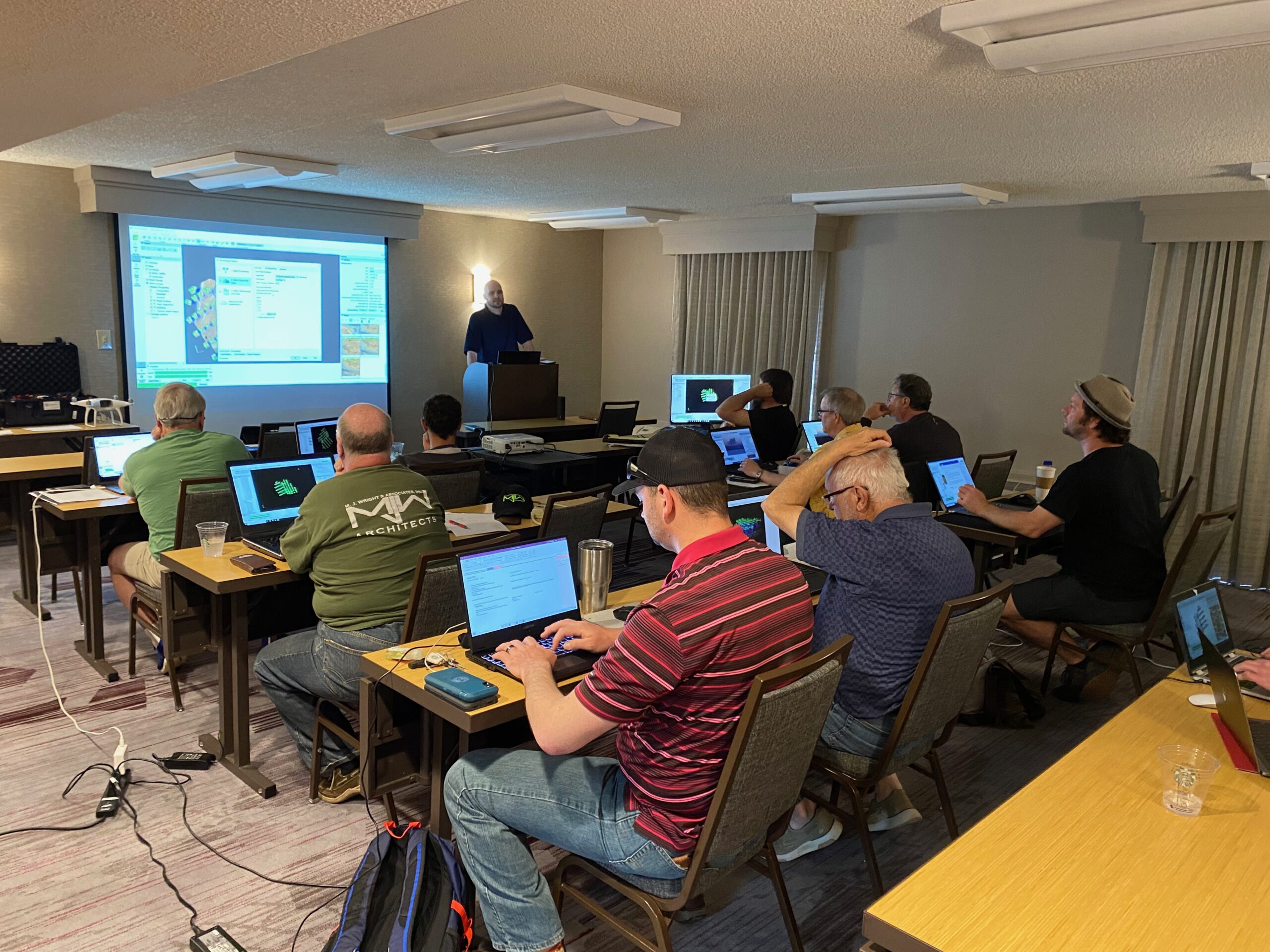
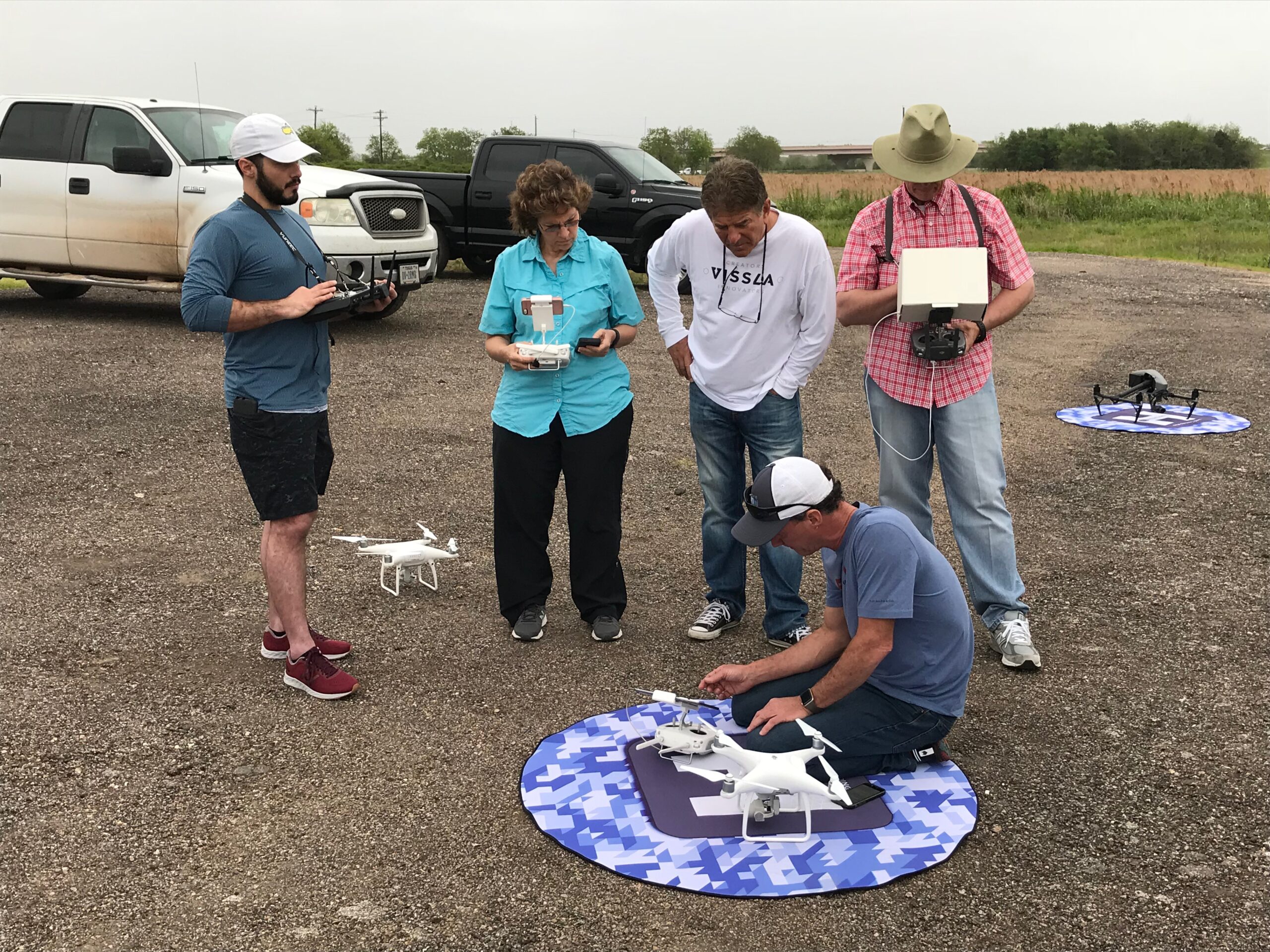
 Provided in person preparatory training for the FAA Part 107 exam as well as flights over water training.
 We’ve trained dozens of Weitz pilots both online and in person. From Part 107 prep to Flight Mastery and Mapping Boot Camps. We’ve been a trusted advisor as they’ve built their program over the past few years.
 One of our more exciting training opportunities, we’ve been onsite at the NTSB Training Academy multiple times to provide accident reconstruction with drones training; a complex and important element of the work they do. They’ve also had pilots attend other training events we’ve held.
 We’ve been NYPA’s training partner and/or UAS consultant since late 2021. This includes over 120 pilots who’ve prepped for Part 107 on our PROPS LMS, and dozens of pilots we’ve trained in person on Flight Mastery and drone mapping. We’ve also consulted on their UAS training manual and SOPS.
 Several drone pilots from the Geico aviation team took multiple courses on our PROPS LMS platform. Including Part 107 Prep, Safe Drone Operations, Don’t Crash Courses, and many others.

3.5 Hours 30 Lessons

Paul Aitken
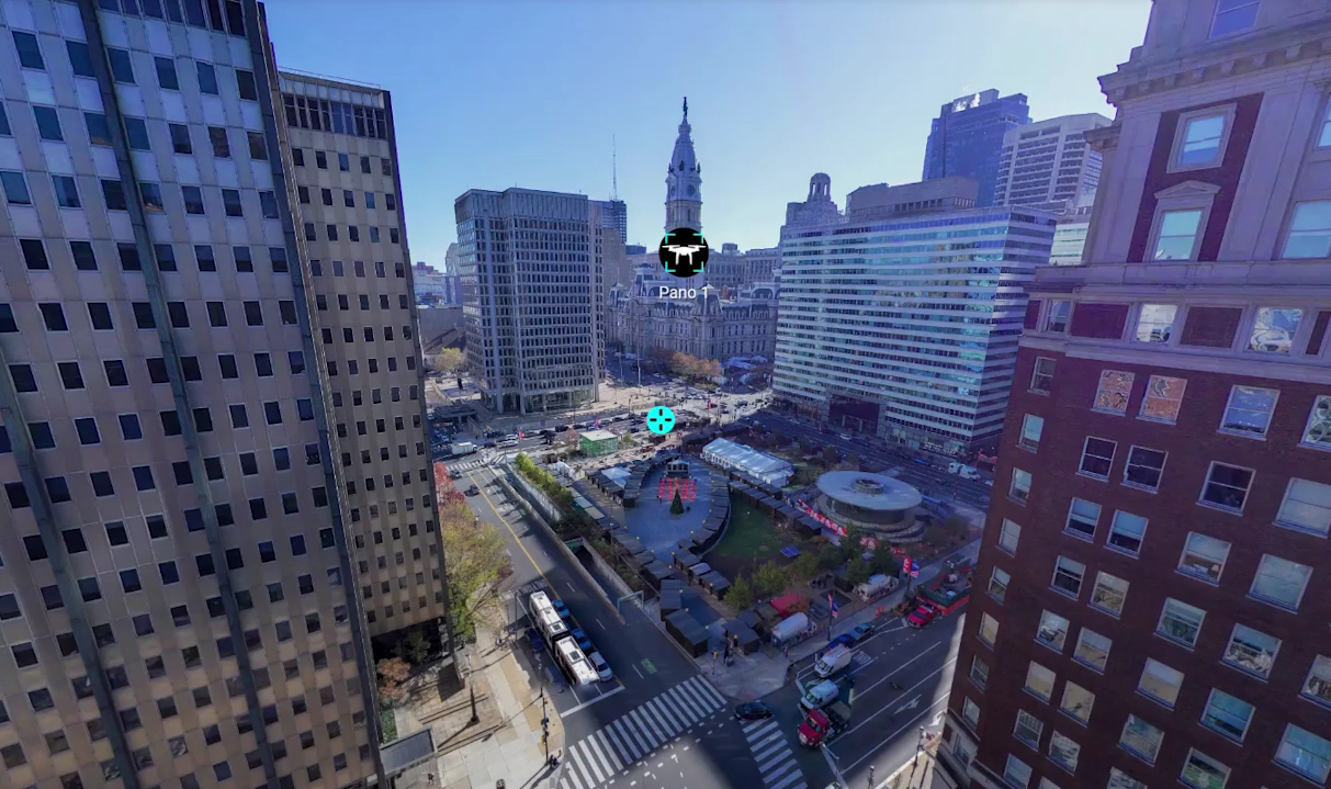
This course empowers you to create stunning aerial footage and immersive virtual tours that captivate clients, enabling you to deliver exceptional results that clients value and pay premium rates for.
5 Hours 29 Lessons
Izzy Mohamed
Discover how to transform property listings into immersive experiences with Kuula—an intuitive, budget-friendly platform designed for creating stunning 360° virtual tours. Whether you're working in real estate, architecture, hospitality, construction, education, or beyond, this course will empower you to elevate your digital presence and captivate your audience.

3.5 Hours 6 Lessons
Paul Aitken
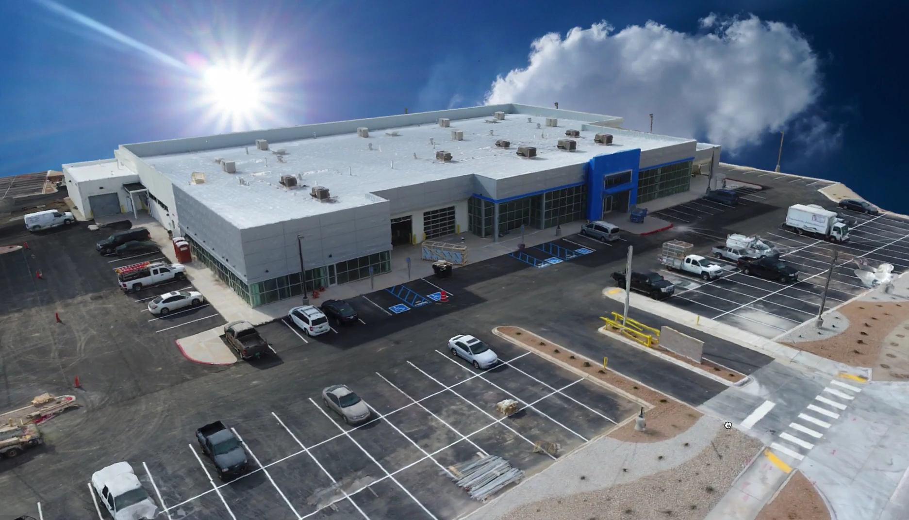
Create stunning 3D models and virtual tours that captivate clients and streamline decision-making. Master advanced techniques for data capture, processing, and visualization. Deliver high-quality deliverables that set you apart from the competition.
Safe Drone Operations
2 Hours 15 Lessons
Paul Aitken
Master the art of safe drone operations in challenging construction environments. This course covers essential safety protocols, risk management strategies, and emergency procedures.

We're confident you'll love this course, but if for any reason you don't, we've got you covered with a no-fuss 30-day money-back guarantee.

Get direct answers to your questions, and learn from your peers in our friendly and supportive community forum.

Learn from instructors with real-world experience in drone mapping and modeling, bringing you practical wisdom and insights.

This training empowers you to master the practical workflows of creating 2d maps and 3d Models in a variety of softwares so you can always get the job delivered.

Once you're in, you're in for life. Come back anytime for a quick refresher. Never loose access to a course you have purchased.

Learn from the pioneer in drone training with over 20,000 drone pilots trained and a vast experience spanning a decade
Paul Aiken is a highly accomplished drone industry leader, educator, and aerial data specialist with over a decade of experience pushing the boundaries of UAV technology. A graduate of the University of New Mexico with a degree in criminology, Paul has also studied international finance at Charles University in Prague and holds graduate certificates in data analytics from MIT.
Since entering the drone industry in 2011, Paul has built an impressive track record as a DJI-sponsored pilot for nearly 11 years, winning awards such as Video of the Year for the World Series of Wakesurfing. His expertise extends across mapping and inspections, having successfully mapped most of the baseball stadiums in the U.S. for radar inspection and interference mapping and contributed to large-scale construction and infrastructure projects.
Paul has trained and developed some of the largest drone programs in the country, spanning construction, utilities, and critical infrastructure. As a certified photogrammetry instructor with Pix4D, he is passionate about creating data-driven training systems that enhance flight precision, limit liability, and instill confidence in drone operators. With a deep expertise in flying low, close, and smooth in any environment, Paul continues to advance the industry by integrating cutting-edge drone technology with real-world applications.
This one-time payment gives you ongoing access to all the training, resources, and tools you need to master real estate services at your own pace.

I recently completed Drone U’s in-person Mapping Bootcamp as well as their in-person Flight Mastery & Videography training, and the entire experience far exceeded my expectations. Paul Aitken and the whole Drone U team bring a level of real-world experience, professionalism, and genuine passion that’s hard to find in this industry.
What impressed me most was how authentic the instruction felt. So much drone training online is repetitive, scripted, or recycled from the same sources. Drone U is the complete opposite. Every lesson came from real field experience, real missions, and real problem-solving. The training was practical, relevant, and immediately applicable to actual commercial work.
The environment was also incredibly supportive. The group I trained with was fantastic — learning alongside such a great mix of people made the experience even better, and I’m grateful to now call them friends.
If you’re serious about improving your drone skills, building confidence, and learning from instructors who truly know the craft, Drone U is absolutely worth it. Their in-person training is on another level.
 Matthew Rickard
I recently attended the 5-day drone mapping workshop at their Colorado location and as someone relatively new to the field I found it was worth every penny and then some. As anyone getting into this field knows, software can get awful expensive quick and this really helped get a better understanding of that landscape. To boot, you get some excellent hands on training with the drones to help learn how to create really impressive 3D models that sing and you get to capture data in live situations (e.g. construction site, landscape supply (volumetrics), etc.) which makes the use cases real. Beyond that, they also helped take the cuffs in terms of knowing how I can fly practice missions legally and how to speak to any authorities should I be approached and told to stand down. That alone was worth the price of admission. All in all, extremely useful for someone new to the game that is trying to get into this business. Oh, and you get to network with other pilots (which was also super useful)
 Douglas Hall
Drone U is a reliable platform for acquiring skills that will turn you into a Drone Pilot Pro! Great exerience.
I really liked the crawl, walk, run approach. The instructors hit the fundamentals thoroughly ensuring those were carried into the rest of the week. The "why" of things was what really mattered. If one can understand the "whys" of things, that will introduce context and transfer into solid learning.
 Joel Andrew
The team at Drone U hit the mark and I can't recommend them more.
After completing the drone mapping class with Paul and Brandon, I couldn’t be more impressed. Unlike some training centers, their approach was truly focused on the student, ensuring everyone fully understood the material and felt confident applying it. Their knowledge and enthusiasm made complex topics — from photogrammetry fundamentals to digital twin creation — easy to understand.
The balance between theory and hands-on practice, including extensive work with Pix4D software, was perfect. We covered everything from flight planning to advanced data processing, and I left confident in my ability to produce accurate, professional-grade datasets and 3D models.
The real highlight was the practical field sessions — applying what we learned immediately helped lock in the concepts. The training materials were clear, well-organized, and packed with valuable tips I’ll be using on future projects. Shortly after returning to North Carolina, I landed a well-paying 42-acre photogrammetry and mapping project, putting these skills to use right away.
Whether you’re new to drone mapping or looking to refine your photogrammetry and digital twin expertise, this class with Paul and Brandon is a fantastic investment in both your knowledge and your career. Highly recommend!
Thanks again Bob R
 Bob Reynolds
I've been a Drone U member for about a year and a half. Love their online courses. Top-notch information. Wanted to understand the total work-flow of mapping from acquiring the data to creating the map/models to the deliverables. Just recently took the in-person mapping course. Outstanding. Paul was great! Knew the all the stuff from actually doing all the stuff. Made it fun too. And all the other attendees made it a great overall experience. Looking to get into mapping and modeling... WHAT ARE YOU WAITING FOR? Sign up for their next class. Ya won't regret it.
Looking for a real inside look at the Drone U Colorado Experience? As someone who attended the 7-day training, I can tell you it's much more than just flying drones. This course is about building serious confidence and mastering the skills you need to succeed in the industry.
What impressed me most was the hands-on approach. I learned how to set up professional interviews, nail the lighting, and edit it all together – skills I can immediately use in my own drone business. The training location was incredible, and the opportunity to connect with other passionate pilots was invaluable.
The trainers at Drone U are top-notch – true experts in their field. If you're looking for a drone course that combines practical, real-world skills with essential business know-how, this is it. Drone U is the real deal!
 John Rodriguez
PAUL YOU WERE RIGHT! The FreeFly Astro is an amazing bird! We love it so far...and thank you and Rob for the training at your Loveland camp we completely enjoyed our time out there. Hope our paths cross again!
All The Best,
Jake D
 Jason Duckworth
I recently completed the Drone U In-Person Training (5 days), and it was an incredible experience. If you're looking to learn to fly drones or enhance your skills, I highly recommend their program. The instructors are experts in drone operations and offer personalized, hands-on guidance throughout the entire process.
What stood out to me was the depth of the training. From the basics to more advanced training techniques, Drone U covers it all. The curriculum is well-structured, ensuring that you’re not just flying a drone, but you’re also learning to understand the technical aspects of drone operations, including safety protocols, troubleshooting, acquisition software, and plenty more!
The in-person format is fantastic, providing real-time feedback and support as you practice in the field. The trainers were always available to answer questions and offer tips to refine my flying techniques, acquisition techniques, mapping skills, and my 3D model processing/editing!
Whether you’re just starting or aiming to elevate your skills to a professional level, Drone U's drone training is the perfect choice to take your flying to new heights. (see what I did there, lol) I feel much more confident in my abilities after completing this advanced training.
Thanks again Drone U! Y’all have exponentially increased my knowledge, comprehensions, workflows, and most importantly….MY PROFITS!! I look forward to the continued substantial growth within my drone company and owe it to you guys!!!
 Michael Barriger
Drone U is an amazing destination for exceptional drone training! Whether you're just starting and want to learn to fly like a pro or already have experience, you’re guaranteed to enhance your skills and knowledge.
I enjoyed learning from Paul and Brandon—they are genuinely top-notch instructors! I wholeheartedly recommend Drone U to anyone looking to elevate their skills and boost their professional value. The advanced training and hands-on experience gave me the confidence to chase my dream of launching a drone company.
Whether you want to explore flying as a fun hobby or dive into the exciting world of the drone industry, master drone operations, and make your passion profitable, Drone U is the perfect place to begin your journey!
Morgan Shirley
Skyline Drone Mapping
 Morgan
TL;DR: The DroneU is the most authentic drone learning platform (not clickbait, isn't worried about clicks or marketing schemes) and goes into depth in their courses that no other platform even attempts to do. They whole-heartly deserve 10 stars (Trustpilot doesn't allow me to give them that)!
My experience: When I first looked into drones in high school, I came across TheDroneU's website and wrote it off because of the website design (in the works, from my understanding); in hindsight, I wish I had not been so shallow and quick to judge. Since that decision, I've tried a number of different online "learning platforms" for niches in drone industries. I've used UAV Coach/Drone Pilot Ground School for my FAA Remote Pilot Certificate (great high school scholarship program) and enjoyed that; the rest of their courses and services seemed to fall short. I've tried DroneFilmGuide (now Stewart & Alina) for their Drone Film Masterclass 3.0 (fairly well done, but very media oriented). I tried both of the classes offered by the Drone Trainer Podcast (now defunct to my understanding) in "real estate" and "mapping". I eventually turned towards the Drone Launch Academy, got hooked by their seminars, and purchased their "mapping", "construction", and "roofing"/"solar" courses. I've even watched all of Dylan Gorman/PilotByte's Youtube videos (a lot of clickbait and mediocracy).
Even though I was exposed to all of these courses, I never felt they went deep enough. I never felt prepared to tackle the markets, to pitch the right idea or product to business professionals, to process my information and media in the right way to provide value. I had no confidence in running my drone business in the right way, despite having a bachelors in business; and I believe it came from having no idea how to properly provide value from drones to clients. One day, I gave TheDroneU a chance, and they have yet to fail me yet.
With the monthly membership, I get access to ALL OF THEIR COURSES! Each course covers the topic (ex. Comprehensive Mapping, Cell Tower Inspections) in depth that only comes from individuals who have not only worked the type of job before, but they understand the science, workflow, clients, and industry of the job. I feel so out of my league, yet hopeful because Paul, Rob, Brandon, and TheDroneU crew CARE ABOUT THEIR COMMUNITY! The DroneU monthly business call is incredibly impactful and insightful. I've seen firsthand how much the staff interact with their students and community members. I'm currently participating in an In-Person Cell Tower Inspection and Mapping Course, and I watched Paul and Brandon give critical and useful feedback. I watched them support their pilots, and even help fix a drone when a training exercise went wrong. They laugh, joke, smile; they're true human beings who speak boldly, and have the experience to back it up.
If you're a drone pilot who is trying to be serious about your craft, start a successful business, and support the pilots across the U.S., then please stick with TheDroneU! There is no better platform; everyone else is either in over their heads, repeating the simple hacks/tips, or is clickbaiting. I hate to dog on other people's efforts, but no one so far has outshined TheDroneU in my opinion. So take the first step! Don't be afraid. You've got this.
 Luca Hoang
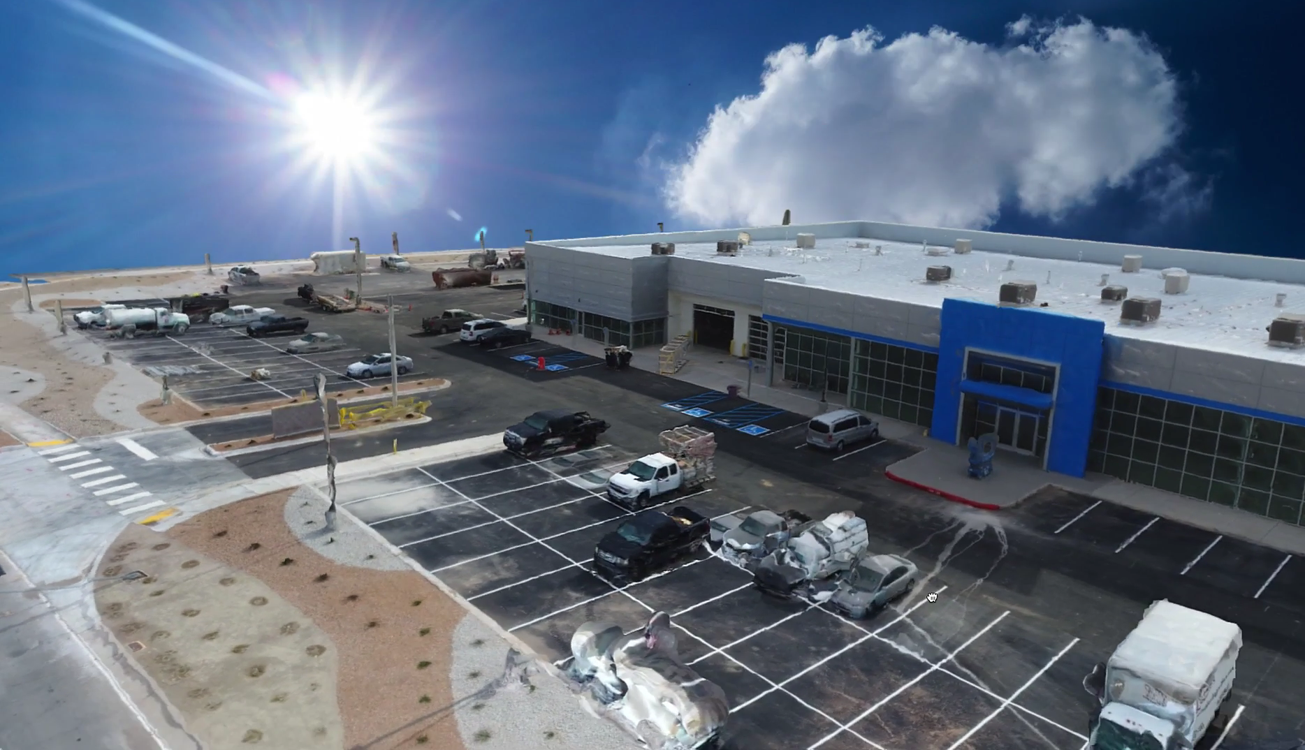
Have been in the Drone industry Since 2017: I am 72 years old, been there and done it. I have wasted a lot of time and money with other Supposed to be great schools IE training for the Part 107 exam. I ended up getting a book from a local FBO and took care of it. That was a waste of 800 bucks that guaranteed to pass the next day. I went to the Mapping boot camp at the facility in Loveland. With experience that they have (over 15 years) was a well taught lesson of the difference of no experience teaching out of the book to teaching with hard learned lessons, learned in the field. With in 3 weeks after I graduated the boot camp; I was ask to give a proposal to an architect to map a 5 acre roof and measure the AC units on the roof, to keep them off the roof. I gave them the proposal and it was accepted. I was coached by Paul the Lead instructor and CEO of Drone U. Below are some point cloud views of the project in PIX4D Mapper. I can’t say enough about there courses.
I am enrolled with the online courses which could be around 50ish. I can go thru them as many as I care to. Funny thing each time I go thru to make sure I have a great work flow, I learn something new each time. As an old man it is great to finally find a school that cares about the students a make sure the understand the basics and work flows that accompany each project. Also one last thing, Safety!!!!! They are on top of it.
Best regards
Jimmy Walker
 Jimmy Walker
I recently attended the in-person Drone Mapping Bootcamp hosted by Drone U, and it was nothing short of amazing! From the moment I arrived, I was greeted by a warm and welcoming team who set the tone for an engaging learning environment.
The instructors were incredibly knowledgeable and passionate about drone technology. They not only covered the technical aspects of mapping but also shared valuable insights from their own experiences in the field. The hands-on training was a highlight for me; being able to operate the drones and see the mapping process in action made everything we learned come to life.
I also appreciated the small class size, which allowed for personalized attention and ample opportunities to ask questions. The curriculum was well-structured, covering everything from pre-flight checks to data processing, and I left feeling confident in my ability to apply these skills in real-world scenarios.
Overall, I highly recommend Drone U’s Drone Mapping Bootcamp to anyone looking to enhance their skills in drone mapping. It was an invaluable experience that exceeded my expectations. Thank you, Drone U, for such a fantastic training opportunity! And a personal thank you to Paul and Brandon for the personalized instruction!
 Dax
Dax
Drone U did an excellent job with the Mapping Bootcamp class I recently attended. The amount of information they taught over over four days was like drinking through a firehose. They managed to ease anxieties and help me retain the info needed to get started with drone mapping. The Mapping Bootcamp exceeded expectations.
I had the pleasure of attending The Drone U's in-person Mapping Boot Camp and Cell Tower Inspection classes this past April. Both courses were loaded with excellent information and practical hands-on experience. I feel like their online content really prepared me for the hands-on components during the in-person courses. Their instructors come from all areas of the drone service industry, and each bring years of their own experience to the classroom. If you want to skip past the noise of other "training" companies and find the professionals, I highly recommend The Drone U. Thanks guys! I look forward to the next one.
-Wes Gilbert
Bozeman, MT
 Wes Gilbert
Had a friend forward me an Ask Drone U podcast a few years back about a subject we had been batting back and forth. Short and thoughtful Q&A about topics that people write or call in about… light hearted and informative. Focused on safety and good solid procedures and strategies for success. It soon got to the point that the podcast made it into the rotation. Started hear from people like me who had turned their hobby into a side hustle or even a full time and profitable profession.
That is when I looked into their classes and programs. I went ahead and decided on investing in a membership so I could access the catalog and be apart of their member community. I figured I would at least give it a year. They was a lot of material I was curious about… so it seemed like a worthwhile venture.
It’s been great. I believe I am into the membership cycle for the third year. I think each year they are actively working on adding and improving.
I’m still part time in my drone work… but my part time is busting at the seems. I very much want to attend in person trainings and I am trying to figure out a way to make life and work happen so I can. I think it would be worth it as well…
There are a few programs out there and I know personality and values play largely on how you learn and respond to the people who you are paying to train you… Paul, Rob and the rest of the staff are genuinely good people who do have the right reasons for doing what they do. They really seem to stay on top of the tech, latest methods and solid strategies. That’s a lot of work… I can’t even imagine. Yet they are all extremely approachable and always reachable. That’s tough too….
There is a lot to balance in a capital intensive industry like drones. Investing in training and ultimately systems for your business is a smart strategy… almost like getting a structural engineer to design your foundation and actually using the right rebar and concrete to do it. You might be able to figure it out on your own… but with a little bit of money and coordination you could actually get some who knows and has experience to help you. This way the house you set on your foundation will last.
I do recommend this group… and I hope this helps you as you do your diligence when picking a group to train and associate yourself with. Thanks,
Gray H.
Plano,TX
 Gray Harrison
The material available to members is extremely helpful and valuable. If you are wanting to self-educate yourself at your own pace, this is the place to go. Great pace that the material is taught, along with updates that keep you in the know how.
Drone U provides exceptional training that builds confidence in drone pilots. Their instructors are knowledgeable and skilled at conveying complex concepts clearly. Whether you're a beginner or experienced pilot, Drone U offers courses for all levels. Their focus on fostering confidence is remarkable, creating a supportive environment where mistakes are seen as growth opportunities. The difference in trained pilots is evident, as the comprehensive training improves piloting skills and equips students to handle challenging situations. Drone U stays at the forefront of the industry by updating programs to reflect the latest technology and regulations. The team is supportive, passionate, and dedicated to student success. I highly recommend Drone U for anyone looking to enhance their drone piloting skills. They exceed expectations with their commitment to building confidence, exceptional training, and knowledgeable instructors. Thank you, Drone U, for empowering me and providing a transformative experience.
I find Drone-U duet Honest and Practical. With drone industry rapid changing technologies and complex regulatory affairs, it's good to have guys like Rob and Paul to mentor you (i.e. Drone University) through these muddy waters of UAV World.
The Drone U is a comprehensive platform for Drone enthusiasts. Whatever your interest the Drone U has courses and podcast to learn from. They also foster a positive community.

My experience with The Drone U's Flight Mastery Class was nothing short of extraordinary! From the start, Paul and Brandon guided me and my classmates through the intricacies of drone flight with unparalleled enthusiasm and insight. Every lesson was intricately designed, providing a blend of theoretical knowledge and hands-on experience that was engaging and invaluable for even an experienced drone pilot like myself. The selected environment was conducive for learning and mastering the skills necessary to navigate the skies confidently and responsibly. I emerged not just with technical proficiency, but with a deep understanding and appreciation for the art of drone flying. If you’re seeking to elevate your drone flight skills to professional heights, look no further than The Drone U! Their Flight Mastery Class is a soaring testament to their commitment to cultivating skilled and responsible drone pilots. Five stars are truly not enough to encapsulate the brilliance of this establishment!!!
The Drone U is the place to learn to be a confident and knowledgable drone operator. I recently participated in the Flight Mastery and Mapping class, and the experience was better than what I could have ever expected. Aside from all the valuable information taught, the individuals teaching are just GREAT HUMAN BEINGS! They really care about everyones growth and your success. Thank you Paul! Thank you Brandon!
The Drone U has been an incredible resource for educating myself in drone safety and overall drone knowledge.
I have taken courses from other “drone experts” and nothing compares to the Drone U. The knowledge they provide goes into far greater depth and detail than I expected. It is the most comprehensive drone school I have found and I am happy to have been a member for almost two years.
Without the Drone U I would be lost in my drone journey! If you are on the fence or have drone related questions I suggest you sign up and try it out. The community that is included with membership is very knowledgeable and always willing to help answer your questions along the way.
These guys deserve a 10/10 rating.
As an aspiring drone pilot, I couldn't help but leap at the opportunity to write drown my exhilaration and appreciation to The Drone U team for the extensive and supremely informative courses offered at The Drone U!
Navigating through the world of drones can be quite daunting. The sky's the limit (literally!), and with the technology advancing at breakneck speed, I found it crucial to get trained by the very best in the field. Enter The Drone U - a beacon of unparalleled knowledge, expertise, and commitment to nurturing drone enthusiasts like myself!
From the get-go, I was enamored by their comprehensive catalog of online courses. Each module is meticulously crafted to cover the A-Z of drone piloting and services, ensuring students are not just 'in the know' but also poised to soar high with confidence and competence.
What truly sets The Drone U apart is their unwavering dedication to quality and student success. The courses are not merely theoretical jargon thrown your way. Instead, they come alive with real-world applications, hands-on training sessions, and invaluable insights from seasoned professionals who've conquered the skies, one drone at a time.
Engaging, enlightening, and empowering – each lesson is a stepping stone towards mastering the art and science of drones. Whether you're a novice with dreams of capturing breathtaking aerial shots or a seasoned service provider keen on refining your skills, The Drone U is your ticket to a thrilling adventure up in the clouds!
But wait, there's more! Beyond the courses, The Drone U community is a treasure trove of resources, networking opportunities, and unending support. Here, learning doesn't cease once a course ends. Instead, it continues, evolves, and transforms into a journey where every day heralds new possibilities and learning moments.
I am not just a student at The Drone U; I am a proud member of a community that thrives on knowledge-sharing, collaboration, and an unquenchable thirst for flying higher and farther. My experience has been nothing short of magical, and I’m stoked to navigate the skies with the unmatched skills and confidence instilled by The Drone U's stellar training programs.
For anyone looking to turn their drone piloting dreams into reality, look no further than The Drone U. With their unrivaled expertise, dynamic courses, and steadfast support, your journey from ground to sky will be as smooth, enjoyable, and rewarding as mine has been!
To the incredible team at The Drone U – thank you for being the wind beneath my wings (or should I say, rotors?). Here’s to many more years of successful flights and delighted students!
Fly high, learn higher with The Drone U! 🚁🌟
Attended the mapping bootcamp and flight mastery training and I am glad that I did. The knowledge and experience was invaluable. Even though I have been flying drones for years, I still learned so much from these guys! If you are a drone pilot (of any skill level) or want to be a drone pilot, join the Drone U community and let them teach you how to up your game!
Been a member for years, this is your one stop shop for drone knowledge. Everything from first flight through mastery and beyond. Incredible group of people, thank you Drone U for all that you have done for me!
This was a great period of instruction. Paul and PJ taught from the ' We've been there' point of view. The hands on Mapping course, coupled with Flight Mastery, is a boon for me and my business. Thanks guys.
Excellent training, excellent content, excellent experience! Can't wait to attend another training course.
No. We show you how to create premium content with entry-level gear, then scale up as you earn more.
Many students land their first $1,000+ job within weeks of mastering our cinematic techniques. It's about the value you create, not your years of experience.
We've helped pilots succeed in markets of all sizes. The key is positioning yourself correctly and targeting the right clients.


