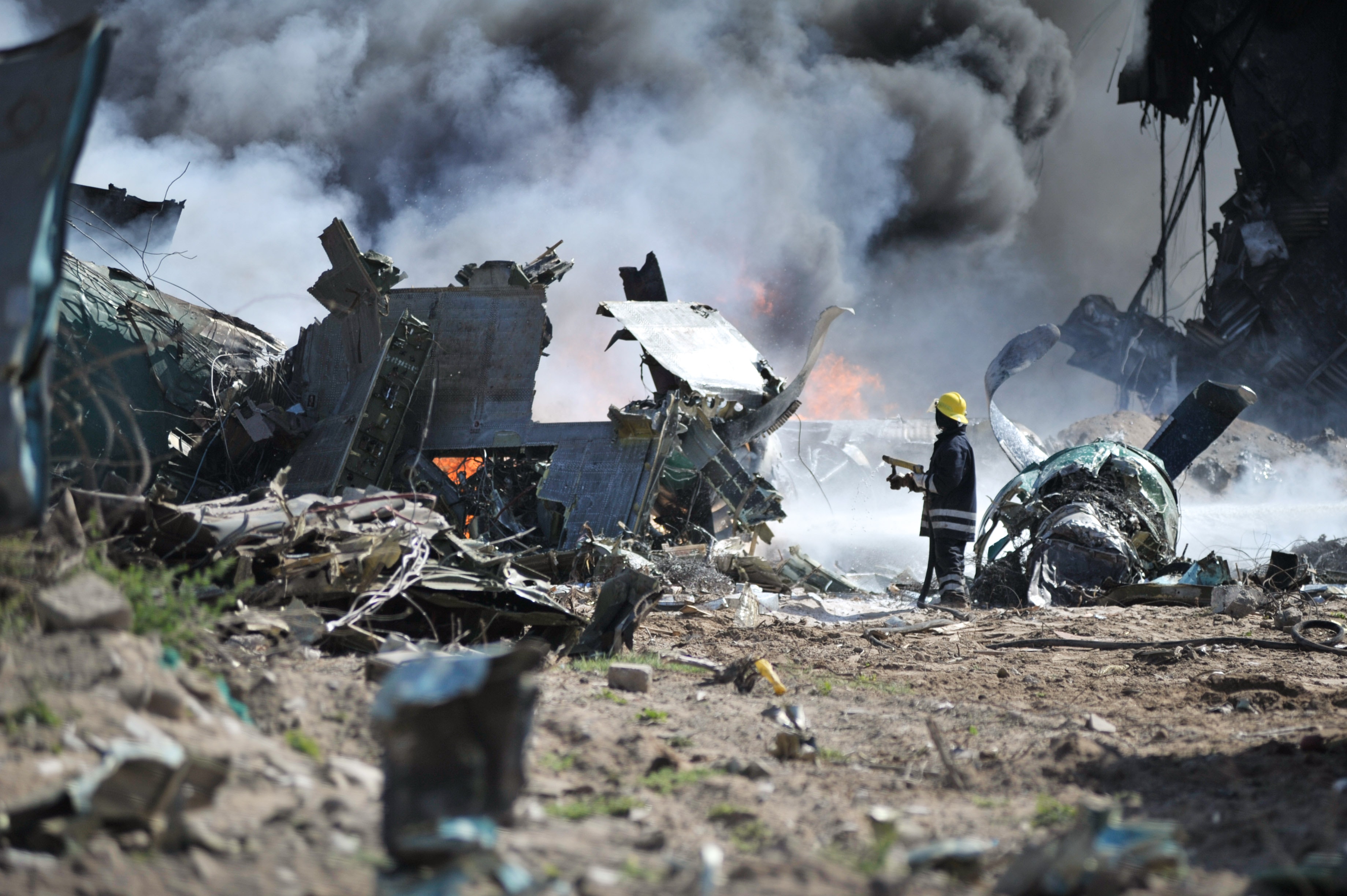
Any crash or derailment that occurs needs to be investigated thoroughly and accurately. By using drones, it is possible to conduct an accident investigation faster, cheaper, and more effectively.
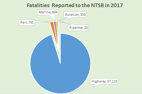
According to the NTSB (National Transportation Safety Board), there were a total of 38,958 fatalities reported in 2017. Here is the breakdown:

In this blog post, we reveal how drones are gradually being integrated into rail, highway, and aircraft accident investigations.
Using Drones for Road Accident Investigation
95% of all 2017 fatalities that were reported to the NTSB were attributed to road accidents. However, accident reconstruction is not feasible in all cases. Typically, it is the severe car crashes rather than the minor fender benders that are investigated.
When conducting an accident investigation, reconstructionists try to find out why and how a car crashed. Typically hired by a lawyer, they work in close collaboration with the police. Some of the critical factors that are considered while reconstructing an accident are the speed of the car, the weight of the vehicle, the angle of the crash, and the amount of rotation. But, is it possible to reconstruct a scene using drone technology accurately? And, is data gathered when using drone technology accurate compared to that of 3D laser scanners?
The Royal Canadian Mounted Police, along with Pix4D, organized an experimental project to gauge the accuracy and effectiveness of drone technology. This project involved reproducing a two-car crash.
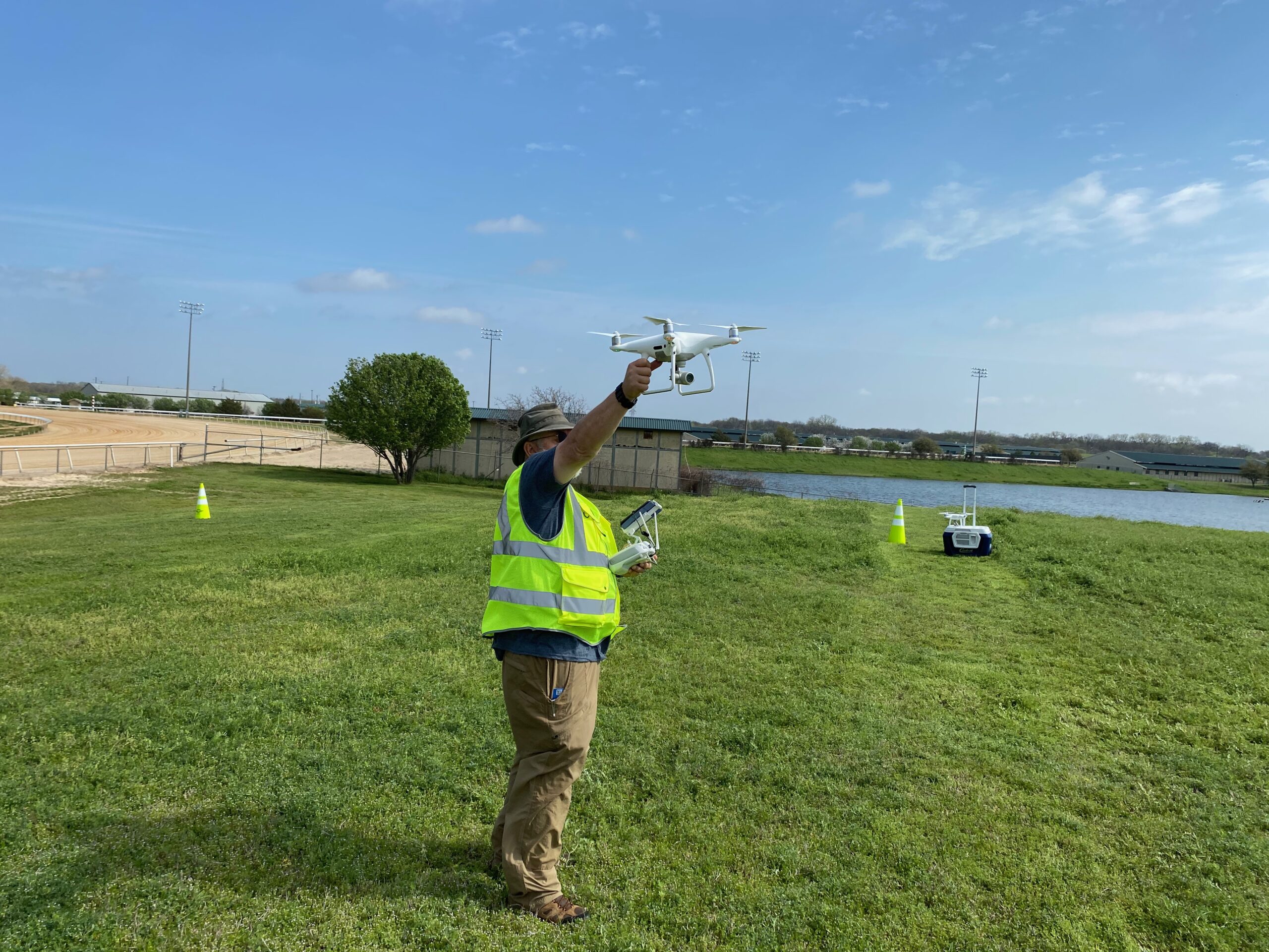
Aeryon and Draganfly drones were used to acquire 400 images for this staged car crash.
Pre-flight preparation took 10 minutes and data acquisition took around 20 minutes. Data processing in Pix4Dmapper took two hours. The end deliverables included a point cloud, Digital Surface Model, and Orthomosaic. Tapes and laser scanners were also used for acquiring data.
It was notable that the data acquired using drone technology exactly matched the data obtained using traditional means. With advantages such as low cost, ease of set up, and rapid data acquisition, drone technology will undoubtedly become the go-to option in the coming years.
You can access the entire Pix4D report by clicking HERE.
Mitigating Risk by Using Drones for Rail Accident Investigation
Back in 2012, a train carrying Butadiene and Hydrogen Fluoride derailed in Louisville, Kentucky. Exposure to these chemicals can severely damage internal body organs. The fact that both these chemicals are highly flammable further aggravated risk. Moreover, because the tracks were laid on the top of a hill, responders could gain access and monitor the situation from one side only.
The drone, a Datron Scout, was used to zip in and out of the emergency area and take images that helped responders better assess the situation.
Because of the possibility of a large-scale explosion, using a helicopter was out of question. According to Doug Hamilton, Louisville Emergency Management Agency Director, “It’s a hell of a lot better photos than we were getting from a helicopter, which can’t be as stable as a drone is.”
By using drones, it is possible to quickly acquire data, free up the accident site, and then conduct a thorough causal analysis.
The only issue with deployment and data acquisition was that poor network connectivity made live-streaming and monitoring the situation in real time impossible in the above case.
How are Drones Being Used in Aircraft Accident Investigation?
On a recent ADU podcast, Cathy Gagne, Technical Analyst for NTSB recalled the recent incident with Ameristar Air Cargo Inc. On March 8th, 2017, a Boeing MD-83 ran off the runway after a rejected takeoff. Fortunately, no one was hurt. After the investigation, it was determined that a stuck elevator was the cause for this failed takeoff.
But, what exactly could have caused the elevator to jam? High winds which exceeded design limits or certification requirements could be a probable reason; however, the airplane was never subjected to such high winds during flight.
Puzzled NTSB investigators then studied the layout of the quarter mile long hangar which was used to hold the MD-83. By using drone technology, a 3D model of the hangar was created, and a computational study was run to simulate how the wind would behave once it entered the hangar. Did the hangar layout result in turbulent winds which could ultimately cause damage to the aircraft? This case is still under investigation and the final cause is yet to be documented.
The above investigation is a rather unique one where drone technology was used for prepping an aircraft performance report. Typically, deliverables for an aerial accident investigation would include overview shots, runways shots, and any ground scars. Another advantage of using drones is that investigators can map runways at a far greater speed causing less disturbance to airspace. In fact, on the show, Cathy shares how she mapped the runway at Greenville without even shutting down airspace.
Become a Drone U Member.
Do not forget to subscribe and listen to Ask Drone U, the #1 drone podcast on iTunes!


Add Your Comment