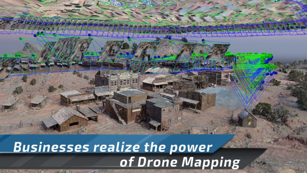
Numerous industries are realizing the power of drone mapping for virtual workplace. Drone maps and models are helping power the virtual workplace by aiding in navigation, logistics and team organizing.
In the age of social distancing, conducting regular business has presented new and numerous challenges. Most businesses have transitioned to working in a virtual workplace. From attending endless meetings on zoom to fruitful trips to the fridge, we are quickly learning our limits of working remotely. Now businesses are realizing how powerful 3D Modeling is to help teams communicate and plan in virtual environments. When you need to work remotely, 3D modeling allows employees to teleport to the project for better decision making.
Project engineers typically need to visit a construction site to coordinate various teams to work together. Now with coronavirus and social distancing, we are being forced to space-out team arrivals. Ensuring that teams work almost sequentially. One team goes in, model the building, annotate and send in the next team. Modeling is keeping businesses moving.
As one team completes the HVAC, the building is modeled again. The project manager now has an updated model of the environment. Now the project manager can point out areas and add visual notes, videos and even photos. 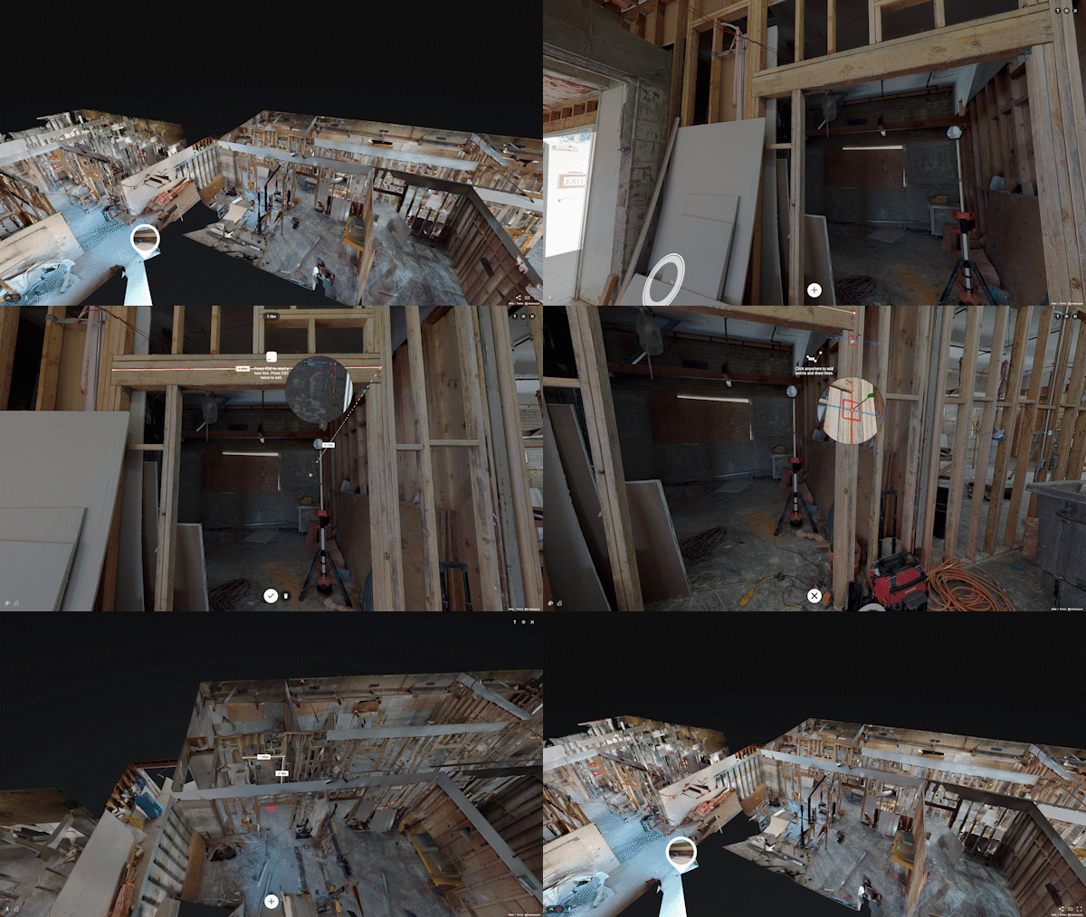
Interior Modeling offers incredible power in communicating with teams, isolating problem areas and saving time. This particular example, an interior model, has been helping those in real estate for years now. Yet, often times the contractors who have learned to model interiors, haven’t learned how to model exteriors. The learning curve for interior modeling has been low, helping numerous industries communicate and coordinate with teams. We are able to create a virtual workplace of our projects that makes working together…easier.
Exterior Modeling…Just taking flight.
Many industries love the convenience and flexibility of interior modeling. Yet few have found an effective way to model exterior environments. From landscape architects to film production, drone mapping / modeling offers significant value to help teams navigate the outside wold. While interior modeling has been around for quite some time, exterior modeling, due to it’s complexity, has had a much more difficult time taking root in the marketplace.
Many clients are wondering why it is so easy to model the inside of a building, but not the outside. The answer is simple, lets call it human nature. The largest photogrammetry engine for building interiors has always kept processing in house. Users simply scan a building and upload the imagery to be processed. The software either spits out a working model, or it doesn’t. There is no in-between.
Exterior modeling hasn’t evolved in the same fashion as interior modeling. While there are cloud processors for exterior modeling, all of the cloud engines focus on 2D data. You’ll see marketing claims everywhere, but there is not a good 3D reconstruction engine on the internet. Frankly, you need extensive knowledge in complex data acquisition and complex reconstruction of said data.
As drone mapping and modeling software has become better with 3D modeling, still very few pilots understand the deeply nuanced workflow. Whether you want a 3D model to use for visualizing a renovation on a building or visualizing a camera position, you’ll need extremely detailed data.
Merging Inside/Outside Models
Arguably, drone mapping provides a level of data companies are not used to, which is one of the biggest problems drone modelers face.
How do you explain the 100’s of deliverables from one drone map or model?
How do you explain the benefits in planning, navigation but also explain how the same data can be used to help sell a project. When we can map the environment, and then place our designs inside of that environment… now we’re working virtually, together.
Often times teams get hung-up on which map to work on. Construction sites are often modeled outside and inside, yet we watch teams struggle to keep all the data organized. Now we merge our data sets together just to keep our information organized. We can use an internet interface to organize our data so it is always available.
There are limited options on displaying this data, but we have found Sketchfab to be the best. For newer users wanting to try things out for free, check out Google Poly. Sketchfab allows us to merge our large overall project map with other interior models and additional media assets.
Deliverables solving unknown problems.
After experiencing drone mapping jobs from around the world, there are more uses for this data than you could ever image. Hopefully we can give you some insight into how digitizing our world really helps us make more informed decisions. Digitizing our world also creates extreme efficiencies in collaborative team efforts.
After modeling baseball stadiums, football stadiums, convention centers and movie sets… I haven’t seen anywhere close to it all. In fact, even though I now have almost 400 mapping projects under my belt, there is still so much to be learned. Below is a list of problems we have solved for other companies with drone mapping data or a 3D model.
- Baseball Stadium | Sports Analytics | Radar Installation Triangulation
-
- Why? To better insure radar accuracy in calculations. Better understand areas of interference.
-
- Construction
-
- Why? To help visualize the existing environment when renovating a building.
- Why? To help better calculate material costs
- Why? To help better understand project timeline due to existing challenges
- Why? To add a 3D rendering over the model to understand zoning site lines.
-
- Film & Production
-
- Why? Like construction VDC, we can plan remotely
- Why? To sequentially send teams out to conduct set design while ensuring social distancing .
- Why? To add visual cues to the storyboard for each shot selection
- Why? To plan each camera movement, export the flight path and have the camera flown autonomously.
- Why? To help each team navigate the set for planning
- Why? To help everyone take linear measurements and understand logistics
- Why? To produce simple maps to help people drive!
-
- Transportation:
-
- Why? To create a model of a bridge, rail or infrastructure to be inspected remotely.
- Why? To reconstruct fatal accidents for more accurate measurements and to remove the crash from traffic faster.
- Why? To measure navigation pathways, egress.
-
- Historical Preservation and Emergency Management
-
- Why? To preserve our beautiful buildings in the case of disaster (Notre Dame?)
- Why? To better understand how to navigate a building for EMS.
-
- Wedding/Event Centers
-
- Why? To provide a virtual storefront that includes vendors.
- Why? To allow virtual planning with event coordinators
- Why? To ensure social distancing measures (its never been easier to measure 6 ft)
-
Our next piece will continue the list. We will call it a thousand ways to save money with drone mapping.
Don’t forget, Drone U has just converted all Drone Mapping Bootcamps to Virtual Class. Including our Interactive 3D Modeling Class which teaches the concepts and executable actions described in this article.



Add Your Comment