Drone U logo
My Account Login Drone U menu
    ×
    • Get Started
      • Get Membership
      • Get Trained
      • Get Pricing
    • Community
    • Training
      • Online Training
      • In-Person Training
      • Training Events
      • Become A Trainer
    • Resources
      • Daily Podcast
      • Blog
      • Popular Topics
      • Modules
      • Tools & Templates
    • About
      • About Us Old
      • As Featured In
      • Become A Member
      • Pricing
      • Reviews
Become A Member
DroneU expertise
DroneU tools
DroneU fleets
Launch business
DroneU community
For individual
For fleets
Methods & secrets of top drone pilots
Methods & secrets of top drone drone companies
Fly better
  • Home
  • / Pix4D Interview | Nuances Of...
Previous Next

Pix4D Interview | Nuances of Drone Mapping

How the Smallest Variables Can Have a Huge Effect on Mapping – Interview with Pix4D

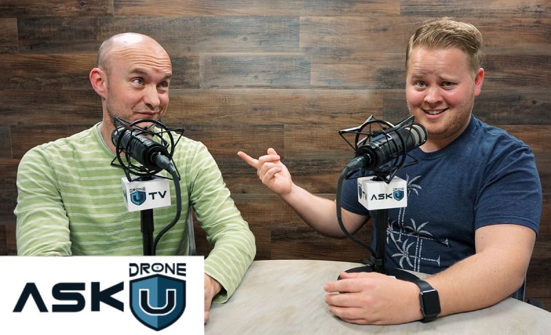
Drone U Chief Pilot, Paul Aitken recently headed off to Denver, Colorado to attend  AUVSI Xponential 2018. In today’s episode he is joined by Angad Singh from Pix4D  to discuss best practices in drone mapping. Paul and Angad talk about Pix4D’s wide ranging capabilities. They provide some expert tips for accurately integrating drones and photogrammetry into your workflow.

How can you produce accurate drone mapping data for crime scene reconstruction and NDVI mapping? How do you generate the ultimate and most beautiful 3D model using photogrammetry? Can you really produce a good drone mapping model in windy conditions?

We also talk at length about camera sensors. Learn how the resolution and focal length of your sensor can impact your image quality. We wrap up this informative episode by talking about using drones in agriculture. Why should you always use a radiometrically calibrated sensor for NDVI mapping? Can drones really help address the global problem or food security? Tune in to this very special episode of Ask Drone U. Fly Safe!

The 2018 Drone U Fly-in is your opportunity to build community, get inspired and fly better. Get practical, hands-on flight instruction from industry’s best. Limited spots available. Reserve now!

Make sure to get yourself a Drone U landing pad!

Get your questions answered: https://thedroneu.com/.

If you enjoy the show, the #1 thing you can do to help us out is subscribe to it on iTunes. Can we ask you to do that for us really quick? While you’re there, leave us a 5-star review, if you’re inclined to do so. Thanks! https://itunes.apple.com/us/podcast/ask-drone-u/id967352832.

Follow Us

Site – https://thedroneu.com/
Facebook – https://www.facebook.com/droneu
Instagram – https://instagram.com/thedroneu/
Twitter – https://twitter.com/thedroneu
YouTube – https://www.youtube.com/c/droneu

Get your copy of “Livin’ the Drone Life” – //amzn.to/2nalUDH
Get your copy of our Part 107 Study Guide – //amzn.to/2omQatT

Timestamps

  • [00:22] Paul introduces Angad Singh from Pix4D; Angad helps integrate drones and photogrammetry into your workflow
  • [01:57] Can you achieve survey grade data using Pix4D?
  • [03:00] Discussing the importance of intimately understanding how Pix4D works
  • [04:06] Angad talks about the different industries that he works with
  • [05:08] Top 3 industries that are benefiting from drone technology
  • [05:36] Tips and tricks for using drone mapping in crime scene reconstruction
  • [08:25] The challenges of turning a 3 dimensional earth surface into 2 dimensional flatland
  • [09:26] Discussing Pix4D capabilities
  • [13:33] How does the focal length of the sensor affect the accuracy of your maps?
  • [15:02] Why should you never zoom in or out while doing accident reconstruction?
  • [15:44] How can the ground sampling distance impact the accuracy of your data-set?
  • [16:38] How does the resolution and focal length of the sensor affect image quality?
  • [17:41] How can you get the best possible resolution with a DJI Phantom 4 Pro? Learn how you can achieve a 1 cm Pixel size by processing data in Pix4D
  • [19:40] Will using different templates for processing data from Nadir, cross hatch and orbit missions result in greater accuracy?
  • [20:06] How to produce a visually appealing drone mapping model using photogrammetry
  • [22:13] Can you produce good drone mapping data in windy conditions?
  • [24:36] Angad discusses the various nuances of NDVI mapping
  • [25:38] What is radiometric calibration? We talk about the important of using the right sensor and producing data that is radiometrically calibrated
  • [27:01] How can drones help address the critical issue of food security?
  • [28:39] Learn how the ability of using the Pix4D Ag deliverable across different platforms renders it truly beneficial
  • [30:50] What is the difference between a linear rolling shutter and global shutter? Can using a linear rolling shutter cause disruptions to your content?
  • [33:43] Angad shares his contact information

Apple PodcastsGoogle PodcastsPlayer EmbedShare
Leave a ReviewListen in a New WindowDownloadSoundCloudStitcherSubscribe on AndroidSubscribe via RSSSpotify

Subscribe & listen to Ask Drone U on your favorite platform!

YOU MAY ALSO LIKE...

How important is it to be found in Voice search?

Is voice search critical to getting business? How do pilots go about being found via voice search? Today's episode is brought to you by Drone U..

Episode Details

Are GCP’s required for Cell tower inspections?

When would pilots need GCPs when performing cell tower missions? What factors do pilots need to keep in mind for taking up multiple cell tower jobs?..

Episode Details

How can I get more clients and grow my drone business?

How can owners grow their drone business? Are there any hacks outside of traditional marketing ways to get clients? Today's episode is brought to..

Episode Details

Can AI change the future of photogrammetry, 3D map generation in the..

Can AI change the future of mapping? How is it being used currently and what capabilities can AI bring? Today's episode is brought to you by Drone..

Episode Details

Can I Use the DJI Smart Controller with Other DJI Drones – Like the..

Can pilots use controllers across different drones? How can pilots confirm the compatibility of the controllers with drones? Today's episode is..

Episode Details

Can I still get jobs with drones such as Phantom, Mini 2 and M2P?

Are newer drones making older equipment irrelevant? Do pilots need to constantly keep upgrading their equipment? Today's episode is brought to you..

Episode Details

Best ways to use GCP RTK and other mapping tools and techniques..

What are the different solutions available for mappers to deliver accuracy in mapping deliverables? How can pilots make cost effective solutions for..

Episode Details

What are some of the DSP gigs available for those willing to travel?..

What are some of the gigs a DSP interested in traveling can take up? What would be a good drone while traveling? Today's episode is brought to you..

Episode Details

How are the best ways to draft my DSP resume?

What are the best ways to draft a DSP resume? What specific points should one include in a resume? Today's episode is brought to you by Drone U..

Episode Details

Who controls the skies OTHER than the FAA?

Do states hold authority on airspace over the FAA? What can one do against state attempting to control airspace Today's episode is brought to you..

Episode Details
ask us

your question

Click the button below to record your question. Please keep it to roughly a minute long, polite, non-spammy and drone or business related. Here are the full submission guidelines

RECORD - LISTEN - SENDRecord a Voice Message

Top 10 Podcasts

  • 1. What should I know about drone insurance?
  • 2. BONUS EPISODE: Michael Singer v. City of Newton (City Drone Ordinance Nullified!)
  • 3. Is there a place for me in the real estate industry if I lack photography and video skills?
  • 4. Is the DJI Spark a good drone?
  • 5. INTERVIEW WITH ANDY LUTEN
  • 6. How to market your drone business
  • 7. DJI Drone Comparison | DJI Phantom 4 Pro, Inspire 1, Inspire 2
  • 8. Can I fly my drone over people if I have their consent?
  • 9. Drone Photography Pricing for land-only drone jobs
  • 10. Can I fly my drone over a road?

Top 10 Blogs

  • 1. Autel Evo 2 vs DJI Mavic 3 – Which Drone Should You Buy in 2020?
  • 2. Part 107 License FAQ | Your Drone Certificate Questions Answered
  • 3. Flying Large Drones Over 55 Pounds Using Section 333 Exemption
  • 4. Drone Insurance FAQ's – How to Get the Best and Most Affordable Coverage
  • 5. LAANC Apps - Using Kittyhawk and Skyward for Approval
  • 6. FAADroneZone - How to Apply for a Part 107 Waiver
  • 7. Little Known Facts About Part 107’s “Visual Line of Sight (VLOS)" Rule That You Might Not Be Aware Of
  • 8. Should You Get Drone Jobs through Drone Base?
  • 9. Flying Drones Over Streets and Moving Traffic
  • 10. Best Drones for Flying in the Wind
Drone U podcast
Drone U podcast
Added to your playlist successfully.
Failed to add in your playlist.
top-arrow

Download our No #1 Resource: Part 107 Study Guide

What's Inside this Guide?

  • 2500+ pages of FAA material broken into digestible easy to read 279 pages
  • Includes over 350 sample quiz & test questions(with answer keys)

This email already exists.

  • Home
  • Portfolio
  • Books
  • Site Tour
  • Podcast Sponsorship
  • Support
  • Contact Us
  • Hire Us
  • FAQs
  • Search
close-search
™ Drone U
  • Legal
  • Privacy