Drone U logo
My Account Login Drone U menu
    ×
    • Get Started
      • Get Membership
      • Get Trained
      • Get Pricing
    • Community
    • Training
      • Online Training
      • In-Person Training
      • Training Events
      • Become A Trainer
    • Resources
      • Daily Podcast
      • Blog
      • Popular Topics
      • Modules
      • Tools & Templates
    • About
      • About Us Old
      • As Featured In
      • Become A Member
      • Pricing
      • Reviews
Become A Member
DroneU expertise
DroneU tools
DroneU fleets
Launch business
DroneU community
For individual
For fleets
Methods & secrets of top drone pilots
Methods & secrets of top drone drone companies
Fly better
  • Home
  • / How Can I Perform Low...
Previous Next

How can I perform low elevation mapping with my drone?

How can pilots perform low elevation mapping? How low can pilots fly to conduct mapping missions effectively?

Today’s episode is brought to you by Drone U Mapping courses. Drone U’s comprehensive and advanced mapping courses covers range of topics, from mapping fundamentals to mapping technologies, deliverables, safe flying. Our mapping courses have been tailored to give you the best value for your membership. Know more about Drone U mapping courses and how our membership can give you access to all courses.

Today’s show is a short quick one where we address the minimum height a drone can fly for conducting a mapping mission.

Our question for today is from Marc, who is looking to map a cemetery and would like to fly very close to the ground for mapping the area. Thanks for the question, Marc.
In this short podcast we address the minimum height for photogrammetric missions and how pilots can fly less than 10 feet and gather data. We also cover the steps for low height data acquisition. Tune in today !!

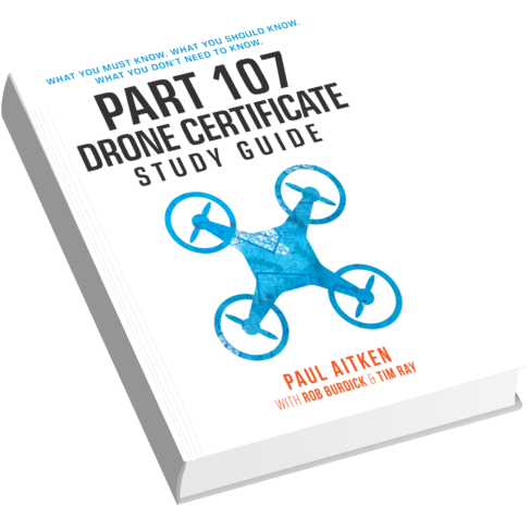
Get Your Biggest and Most Common Drone Certificate Questions Answered by Downloading this FREE Part 107 PDF

Make sure to get yourself the all-new Drone U landing pad!

Get your questions answered: https://thedroneu.com/.

If you enjoy the show, the #1 thing you can do to help us out is to subscribe to it on iTunes. Can we ask you to do that for us real quick? While you’re there, leave us a 5-star review, if you’re inclined to do so. Thanks! https://itunes.apple.com/us/podcast/ask-drone-u/id967352832.

Become a Drone U Member. Access to over 30 courses, great resources, and our incredible community.

Follow Us

Site – https://thedroneu.com/

Facebook – https://www.facebook.com/droneu

Instagram – https://instagram.com/thedroneu/

Twitter – https://twitter.com/thedroneu

YouTube – https://www.youtube.com/c/droneu

Timestamps

[01:40] Today’s question on how low can a drone fly for a photogrammetry mission
[02:48] Whats the minimum a drone can fly for a mapping mission
[03:31] Our recommendation for acquisition of data at low heights

Apple PodcastsGoogle PodcastsPlayer EmbedShare
Leave a ReviewListen in a New WindowDownloadSoundCloudStitcherSubscribe on AndroidSubscribe via RSSSpotify

Subscribe & listen to Ask Drone U on your favorite platform!

ask us

your question

Click the button below to record your question. Please keep it to roughly a minute long, polite, non-spammy and drone or business related. Here are the full submission guidelines

RECORD - LISTEN - SENDRecord a Voice Message

Top 10 Podcasts

  • 1. What should I know about drone insurance?
  • 2. BONUS EPISODE: Michael Singer v. City of Newton (City Drone Ordinance Nullified!)
  • 3. Is there a place for me in the real estate industry if I lack photography and video skills?
  • 4. Is the DJI Spark a good drone?
  • 5. INTERVIEW WITH ANDY LUTEN
  • 6. How to market your drone business
  • 7. DJI Drone Comparison | DJI Phantom 4 Pro, Inspire 1, Inspire 2
  • 8. Can I fly my drone over people if I have their consent?
  • 9. Drone Photography Pricing for land-only drone jobs
  • 10. Can I fly my drone over a road?

Top 10 Blogs

  • 1. Autel Evo 2 vs DJI Mavic 3 – Which Drone Should You Buy in 2020?
  • 2. Part 107 License FAQ | Your Drone Certificate Questions Answered
  • 3. Flying Large Drones Over 55 Pounds Using Section 333 Exemption
  • 4. Drone Insurance FAQ's – How to Get the Best and Most Affordable Coverage
  • 5. LAANC Apps - Using Kittyhawk and Skyward for Approval
  • 6. FAADroneZone - How to Apply for a Part 107 Waiver
  • 7. Little Known Facts About Part 107’s “Visual Line of Sight (VLOS)" Rule That You Might Not Be Aware Of
  • 8. Should You Get Drone Jobs through Drone Base?
  • 9. Flying Drones Over Streets and Moving Traffic
  • 10. Best Drones for Flying in the Wind
Drone U podcast
Drone U podcast
Added to your playlist successfully.
Failed to add in your playlist.
top-arrow

Download our No #1 Resource: Part 107 Study Guide

What's Inside this Guide?

  • 2500+ pages of FAA material broken into digestible easy to read 279 pages
  • Includes over 350 sample quiz & test questions(with answer keys)

This email already exists.

  • Home
  • Portfolio
  • Books
  • Site Tour
  • Podcast Sponsorship
  • Support
  • Contact Us
  • Hire Us
  • FAQs
  • Search
close-search
™ Drone U
  • Legal
  • Privacy